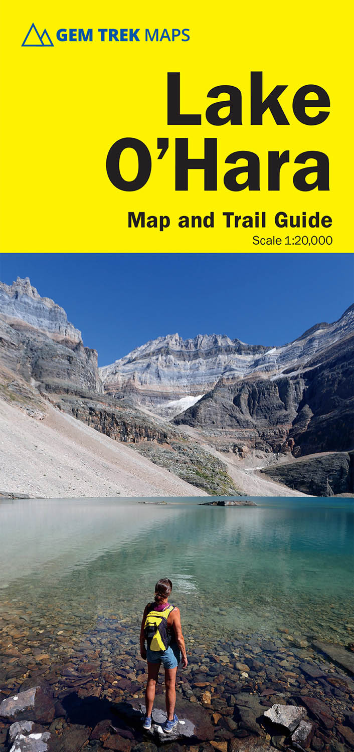
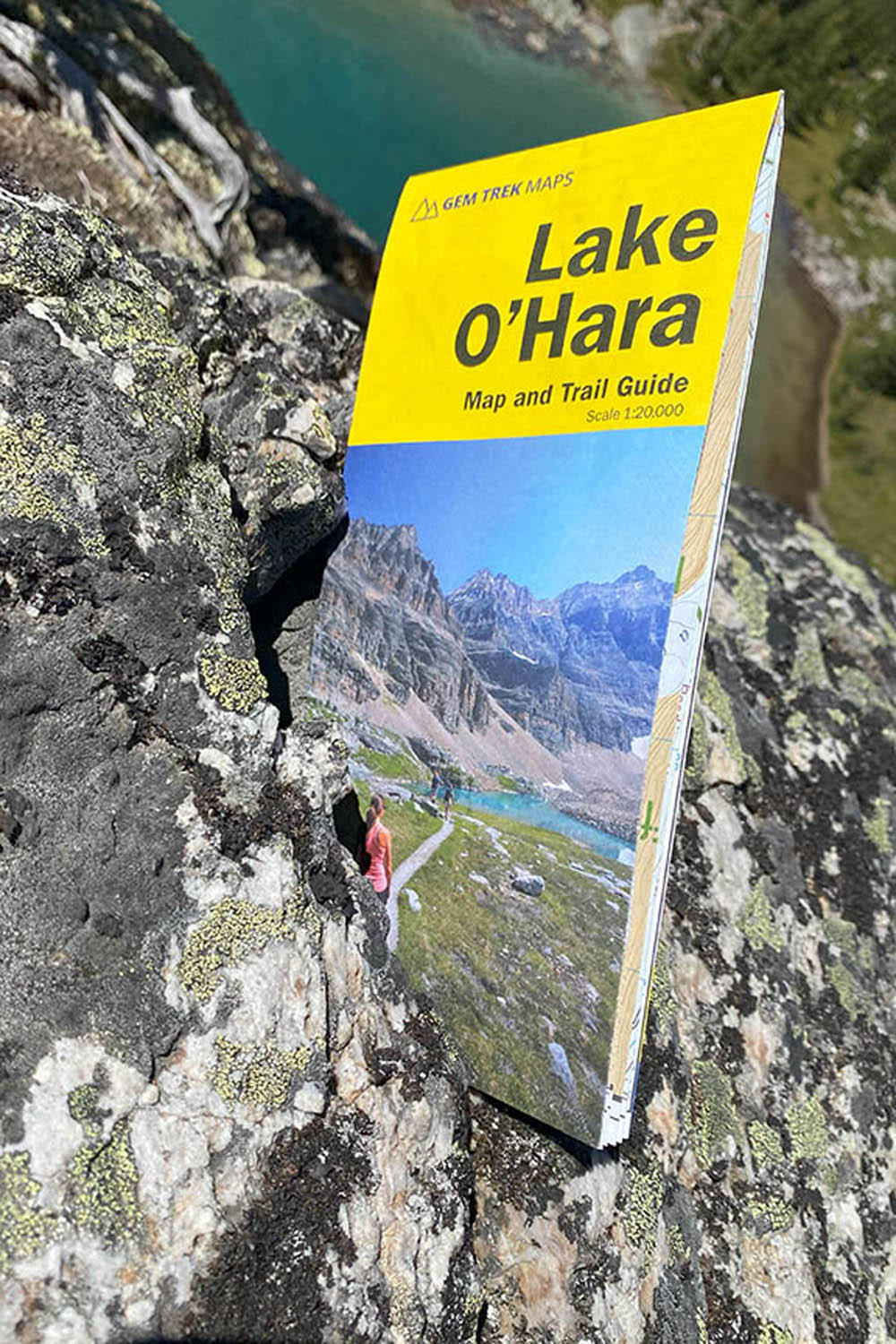
Lake O’Hara Map
ISBN: 978-1-990161-22-3
Scale: 1:20,000
Edition: 5th, 2025
Folded size: 4 x 9 inches
Flat size: 18 x 24 inches
$5.95
Also Available Here
Description
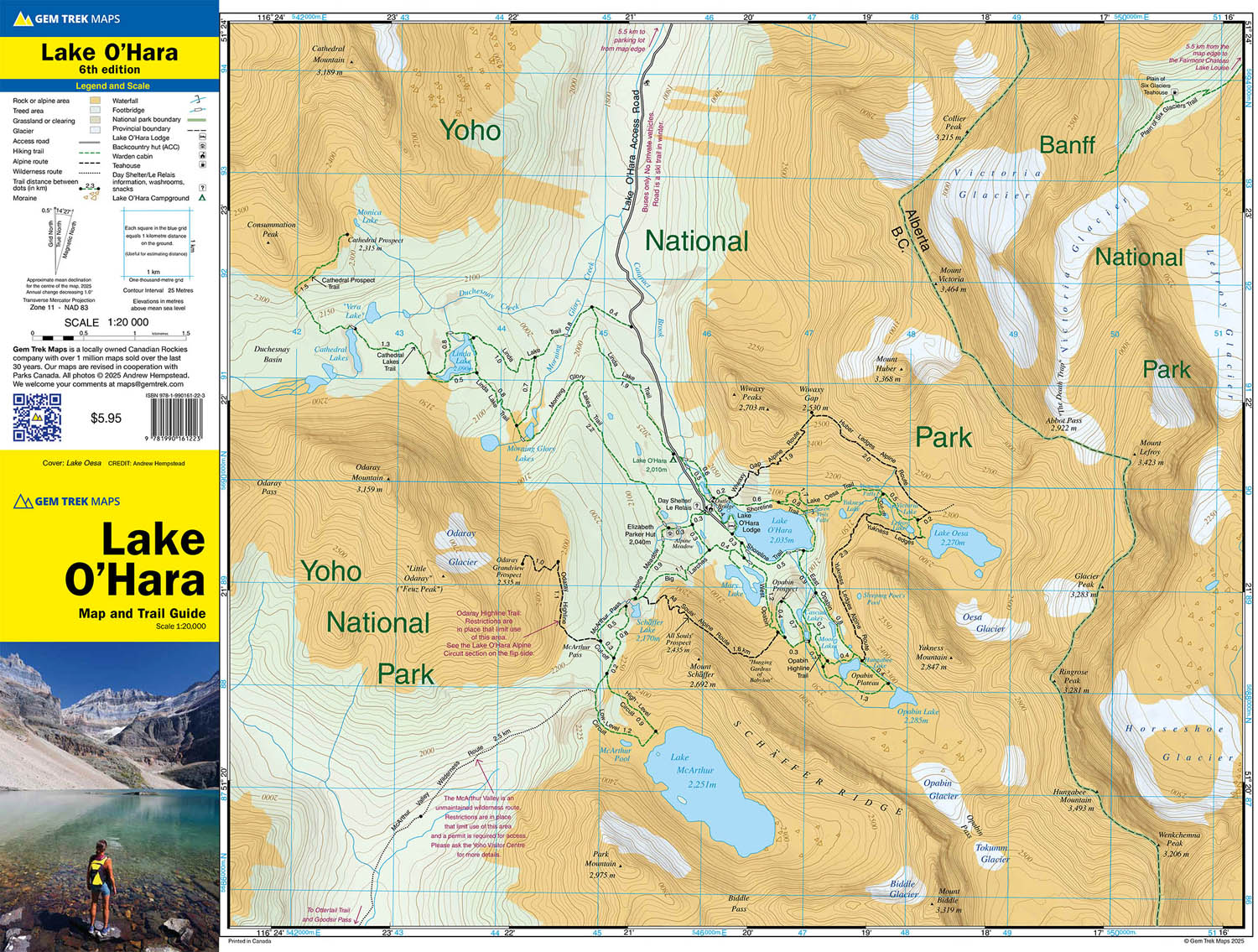
Gem Trek's Lake O'Hara Map is a hiking and recreation map for the Lake O'Hara region of Yoho National Park in the Canadian Rockies.
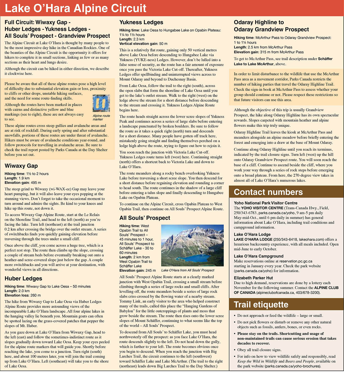
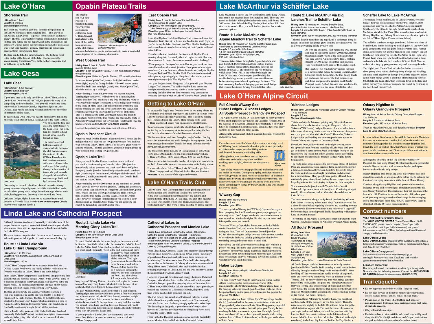
Gem Trek's 1:20,000 Lake O'Hara Map is designed for visitors looking to explore one of the finest backcountry destinations in all of the Canadian Rockies. This map features detailed cartography, accurate hiking trails, and all the most significant natural features of the region. On the back are detailed descriptions of the most popular hiking trails with special emphasis given to the Lake O'Hara Alpine Circuit. Reaching Lake O'Hara, in Yoho National Park, requires advance planning and we help you with information needed to get to the destination, as well as lodge and campground details.
Lake O'Hara Map Coverage
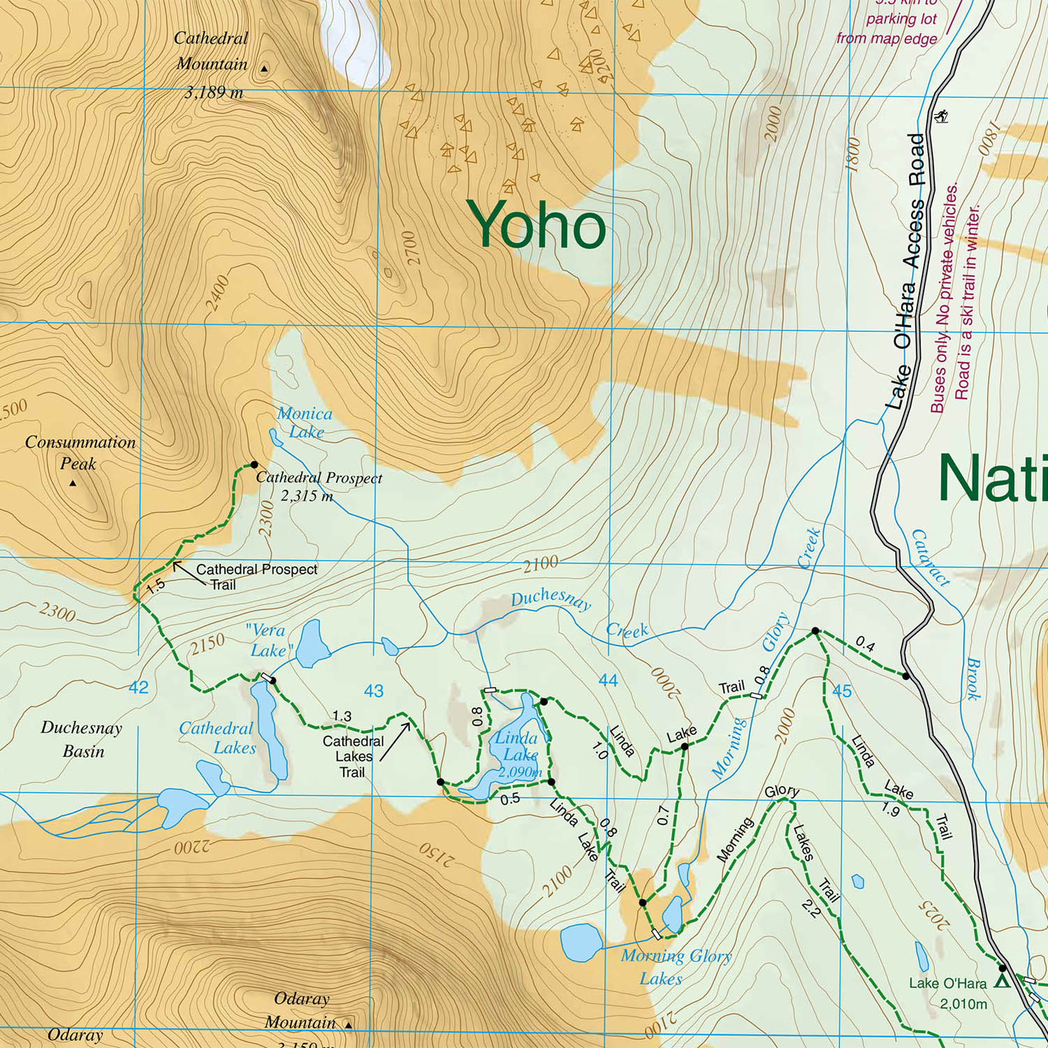
The Lake O’Hara Map covers the entire Lake O’Hara region, from Duchesnay Basin the west to the highest peaks of the Continental Divide in the east and from the access road in the north to Lake McArthur in the south.
Popular hiking trails on Lake O’Hara map include Lake O'Hara Lakeshore, Lake Oesa, Lake McArthur, Opabin Plateau, Linda Lake, Cathedral Prospect, and the Lake O’Hara Alpine Circuit.
Lake O'Hara Map Features
The Lake O’Hara Map includes:
- contour lines at 25-metre (80-foot) intervals
- relief shading to better show the topography
- full colour on both sides
- hiking trails - with trail names and trail distances marked
- hydrology – rivers, glaciers, wetlands, and waterfalls
- mountain names and all available mountain elevations
- lodges and huts