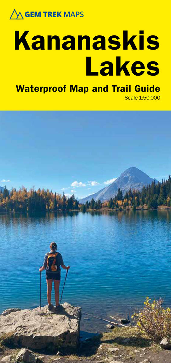

Kananaskis Lakes Map
ISBN: 978-1-990161-13-1
Scale: 1:50,000
Edition: 8th, 2024
Folded size: 4.5 x 9.5 inches
Flat size: 27 x 36 inches
$14.95
Also Available Here
Description
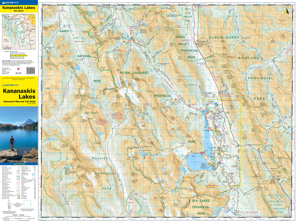
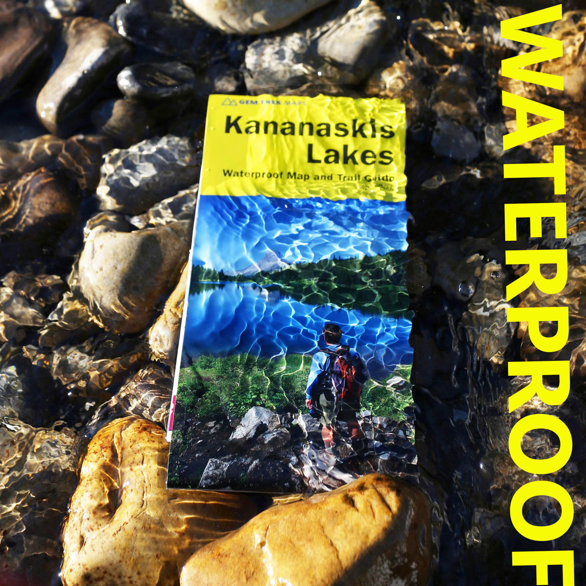
Gem Trek’s KANANASKIS LAKES MAP meets the needs of visitors looking to explore the southern portion of Kananaskis Country. Whether you are touring along the roads or heading into the backcountry, you’ll find the waterproof and tear-resistant Kananaskis Lakes Map to be an invaluable tool.
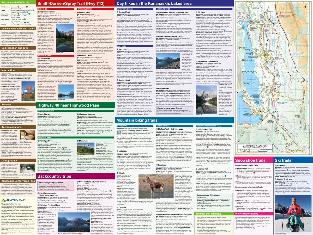
This map features detailed cartography, accurate hiking trails with distances, and details such as logging roads, campgrounds, equestrian routes, picnic areas, and fire lookouts. On the back are descriptions and photos of 16 recommended day hikes, three overnight trips, and nine classic mountain bike rides, as well as six recommended trails for novice and intermediate snowshoers and two areas recommended for cross-country skiing.
Kananaskis Lakes was the first map we published. We've published a post so you can see the evolution of this map since 1991 here.
Kananaskis Lakes Map Coverage
The Kananaskis Lakes Map covers Peter Lougheed Provincial Park, located off Highway 40 south of the Kananaskis Valley. The northern extent of the map is Opal Day Use area on Highway 40 and Engadine Lodge on the Smith-Dorrien/Spray Trail. The southern portion of the map covers Elk Lakes Provincial Park, in British Columbia.
Popular hiking trails on the Kananaskis Lakes Map include Elbow Lake, Chester Lake, Burstall Pass, Headwall Lakes, Kananaskis Lookout, Upper Kananaskis Lake Circuit, Rawson Lake, Elk Lakes, and Ptarmigan Cirque. For adventurous hikers, the remote southern reaches of Banff National Park near Leman Lake are included, as is the trail over Elk Pass to Elk Lakes Provincial Park.
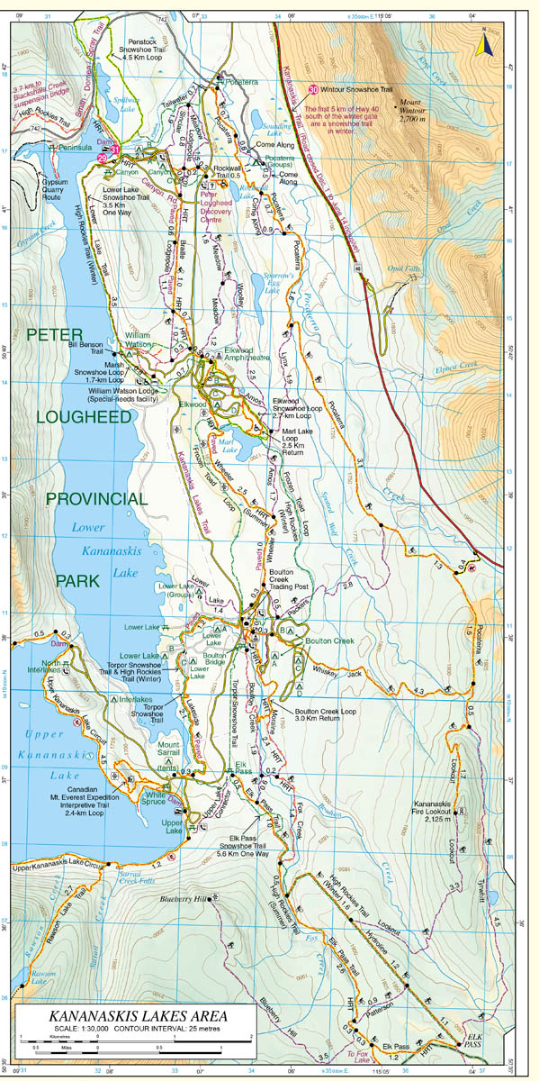
A 1:25,000-scale inset map on the back highlights the Kananaskis Lakes area, including extra detail of hiking trails and campgrounds.
Kananaskis Lakes Map Features
The Kananaskis Lakes Map includes:
- waterproof and tear-resistant paper
- contour lines at 25-metre (80-foot) intervals
- relief shading to better show the topography
- full colour on both sides
- hiking trails - with trail names and trail distances marked
- mountain biking trails - with trail names and distances marked
- hydrology – rivers, rapids, glaciers, wetlands, and waterfalls
- mountain names and all available mountain elevations
- all campgrounds
- points of interest and attractions
- picnic areas
- highway viewpoints